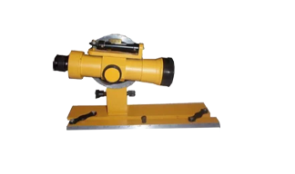
Alidade
Specification:
suitable for maps preparation and recording topography in various engineering surveys.
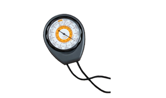
Altimeter
Specification:
The surveying altimeter is a cheap, portable, and easy-to-use method of
determining the relative height differences between points of interest.
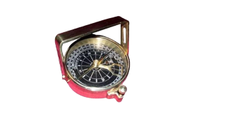
Clinometer Compass
Specification:
In land surveying and mapping, a clinometer can provide a rapid measurement of the slope of a geographic feature, or used for cave survey. In prospecting
for minerals, clinometers are used to measure the strike and dip of geologic formations.
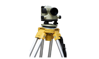
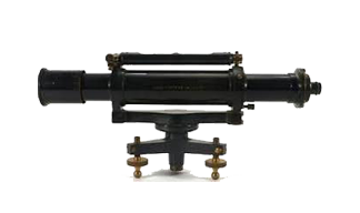
Dumpy Level
Specification:
The dumpy level is an optical surveying leveling instrument consisting a telescope tube firmly secured
in two collars fixed by adjusting screws to the stage by the vertical spindle.The telescope of dumpy level can rotate only in a horizontal plane.
Relative elevation of different points of a surveying land is determined with dumpy level.

Land survey chain
Specification:
Chains are the measuring instrument used in surveying formed by the 100 links of 4mm galvanized mild steel wire. These links are joined by 3 circular or oval wire rings.
These rings provide the flexibility to the chains.
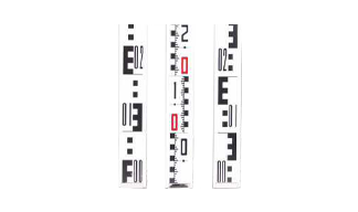
Levelling Staff
Specification:
Level Staff is a graduated aluminium rod,used
with a levelling instrument to determine the difference in height between points or heights of points above a datum surface.
It cannot be used without a leveling instrument.
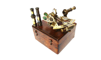
Nautical Sextant
Specification:
is an instrument mainly used to determine latitude and longitude
by measuring angles between two objects.
Plainmeter
Specification:
Offered in a roller-type model this planimeter features an
unique 6-digit pulse count operation that permits cumulative
measurement of areas up to 10m-100 times the measuring
capacity of ordinary planimeters. Enhanced with advanced
micro-processors for accuracy, this instrument is ideal for many
applications where precise large area measurements are
needed, such as in civil engineering, surveying, forest
management, mapmaking and agriculture.
Max. measuring range: 325mm vertical; 30m horizontal
Accuracy: within ±0.2% (within ±2/1000 pulses)

Prismatic Compass
Specification:
A prismatic compass is a surveying instrument which is
extensively used for calculating bearings of survey lines and
included angles between them. Sizes: 4”/6” diameter with
telescopic aluminium folding stave.

Ranginng Rod
Specification:
A ranging rod (or range rod) is a surveying instrument used for marking the position of stations, and for sightings of those stations, as well as for ranging straight lines. Initially these were made of light, thin and straight bamboo,
or of well seasoned wood such as teak, pine or deodar.
Reversible levels
Specification:
This is a combination of the dumpy level and ‘Y’ level. It is supported by two rigid sockets. The telescope can be rotated about its longitudinal axis,
withdrawn from the socket and replaced from one end of the telescope to the other end
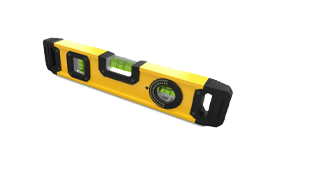
spirit level
Specification:
These leveling instruments as used in surveying to measure height differences over larger distances. A surveyor's leveling instrument has a spirit level
mounted on a telescope (perhaps 30 power) with cross-hairs, itself mounted on a tripod.